Targeted Consultation – 3 Nov to 13 Dec 2022
This consultation has now closed.
We carried out a further stage of targeted consultation on our proposals for Gate Burton Energy Park after making some localised changes to the proposals we consulted on for Stage Two Statutory Consultation which closed in August 2022. This consultation ran from 3 November 2022 until 13 December 2022.
The changes relate to minor amends made to the boundary for the project – known as indicative Order Limits – which result in a small increase in land take. The reasons for these changes relate to the engineering and construction of the project. We also adjusted the indicative Order Limits in a number of places so that they follow field and land ownership boundaries.
This further stage of targeted consultation gave the opportunity to comment on these localised changes to the project.
Key updates to the proposals we consulted on for this stage of Targeted Consultation
The summary map below shows the location of the amends proposed to indicative Order Limits for the project. A map and a description of each change, and the reason for it, then follows.
You can view the individual changes by scrolling down the page. Alternatively click on one of the changes shown on the summary map to go straight to the information available.
Consultation Information Leaflet - Nov 2022
Information about the additional areas we consulted on, including a map, description and reason for the addition, is available to download in this leaflet.
Indicative Order Limits with additional areas
Key


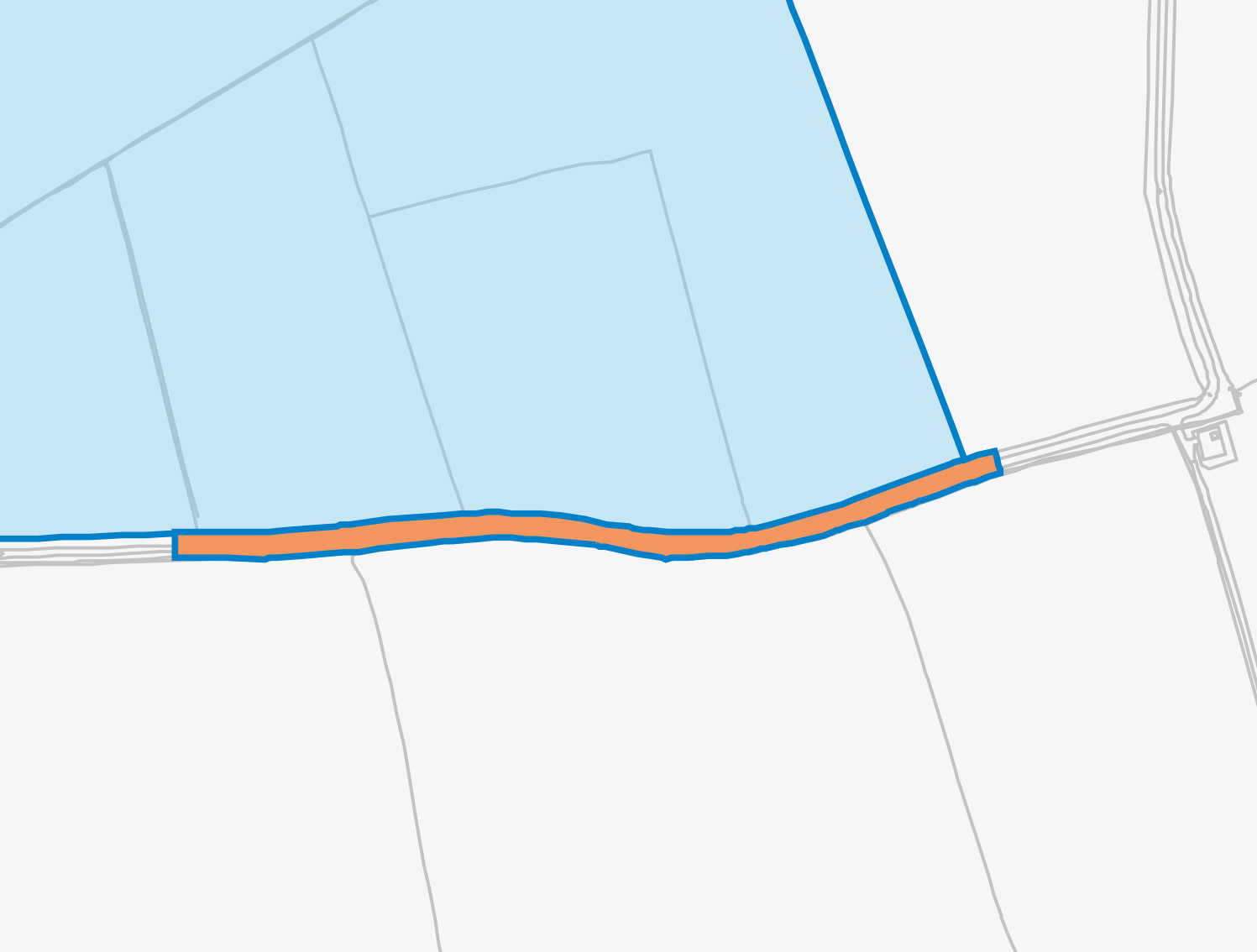
- Kexby Lane East
- Kexby Lane West
- Within site – adjacent to main construction access
- A156 – west of Gate Burton
- A156 – Willingham Road
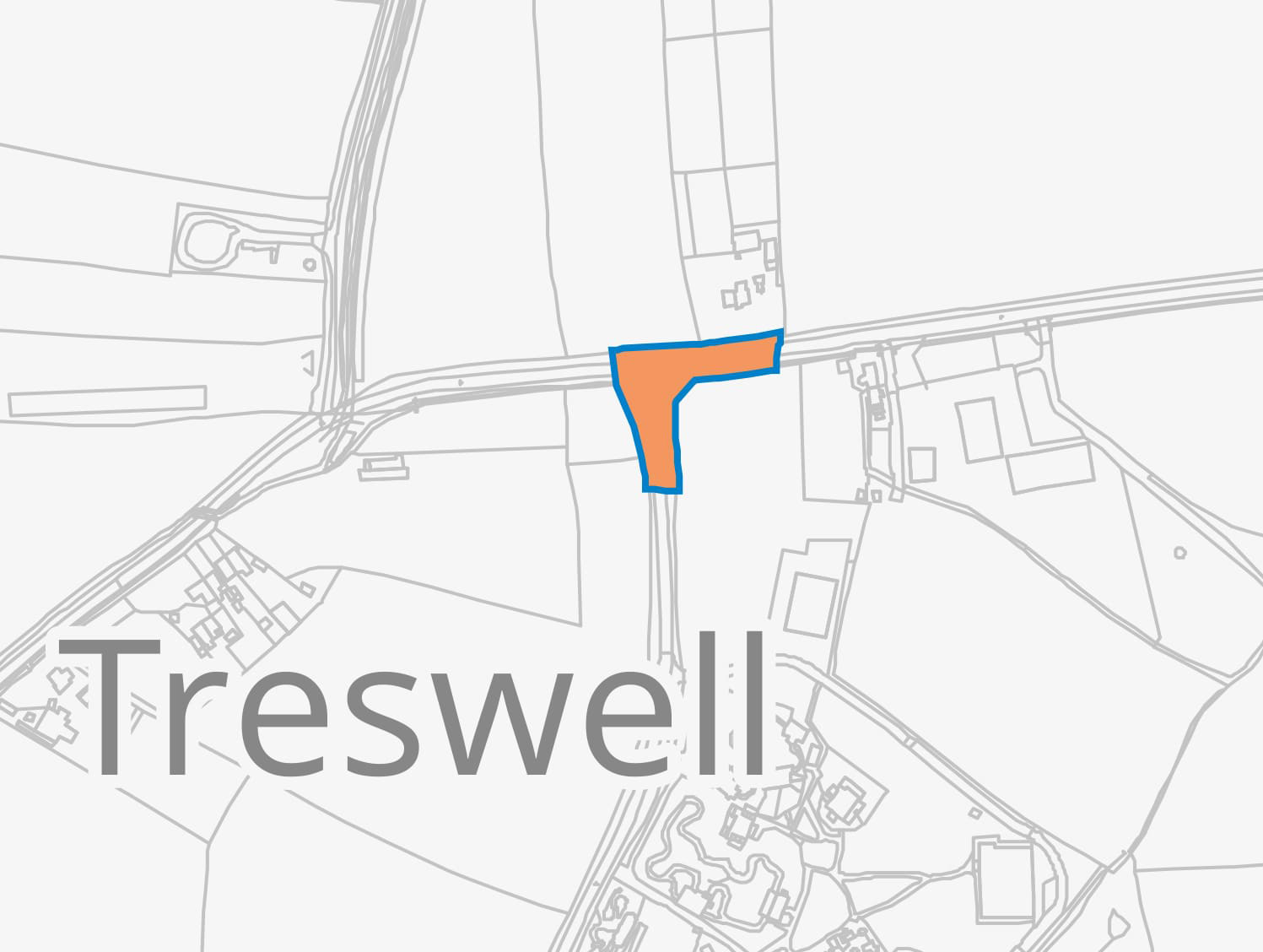
- A156 – 1500 (Stow Park Road) – Littleborough Road junction
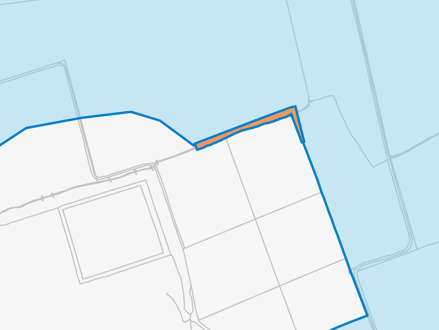
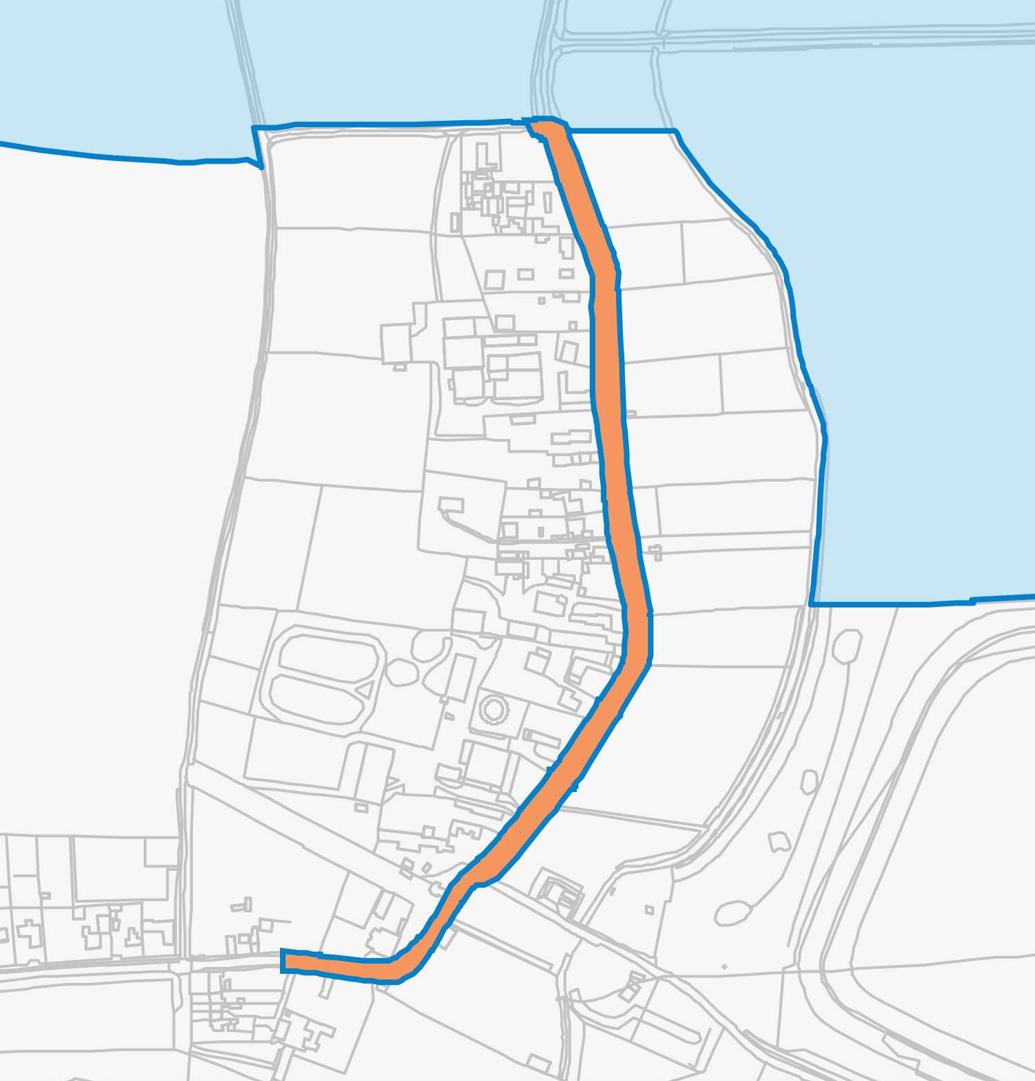
- A156 South of Marton (northern extension)
- A156 South of Marton (southern extension)
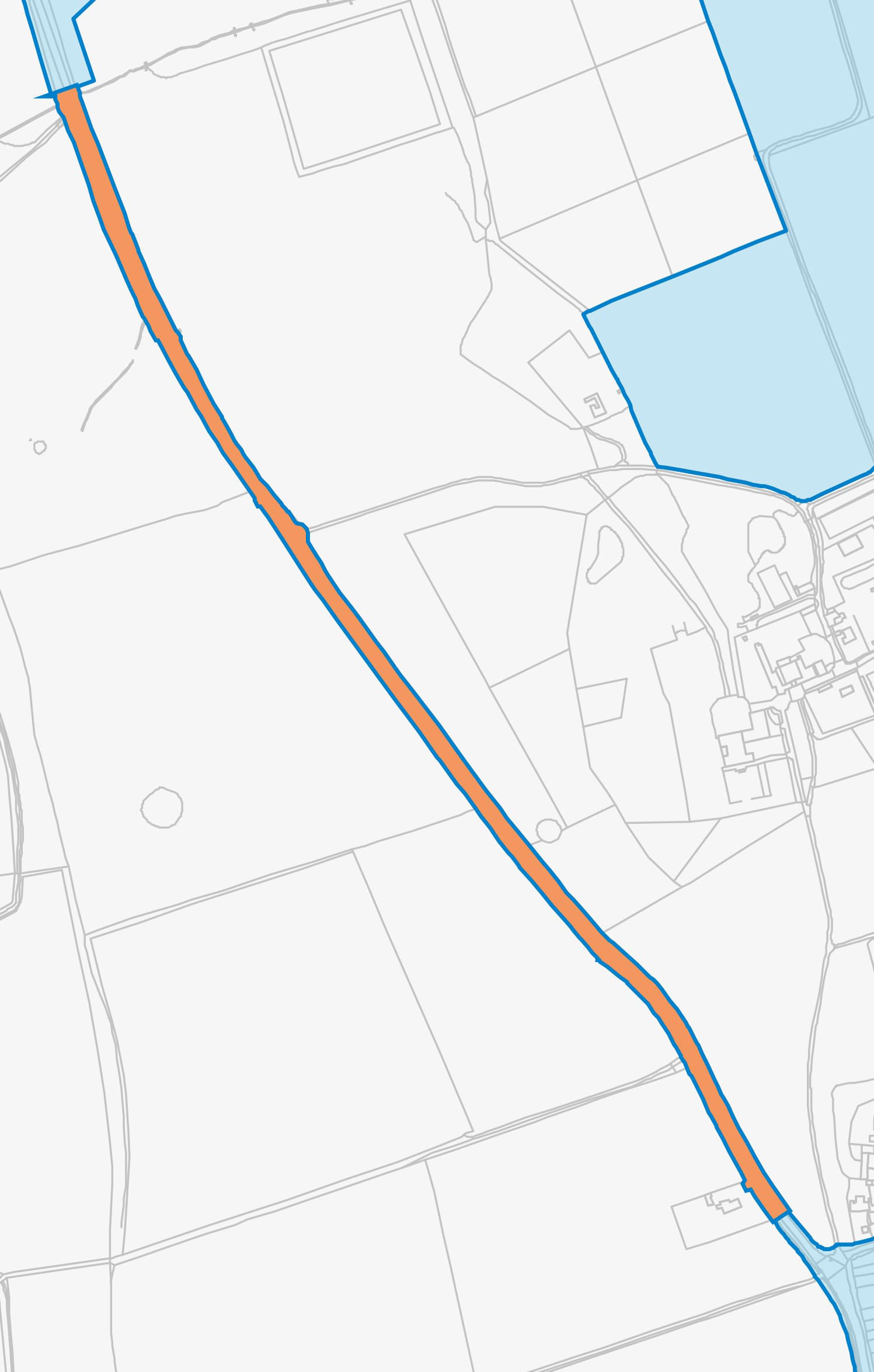
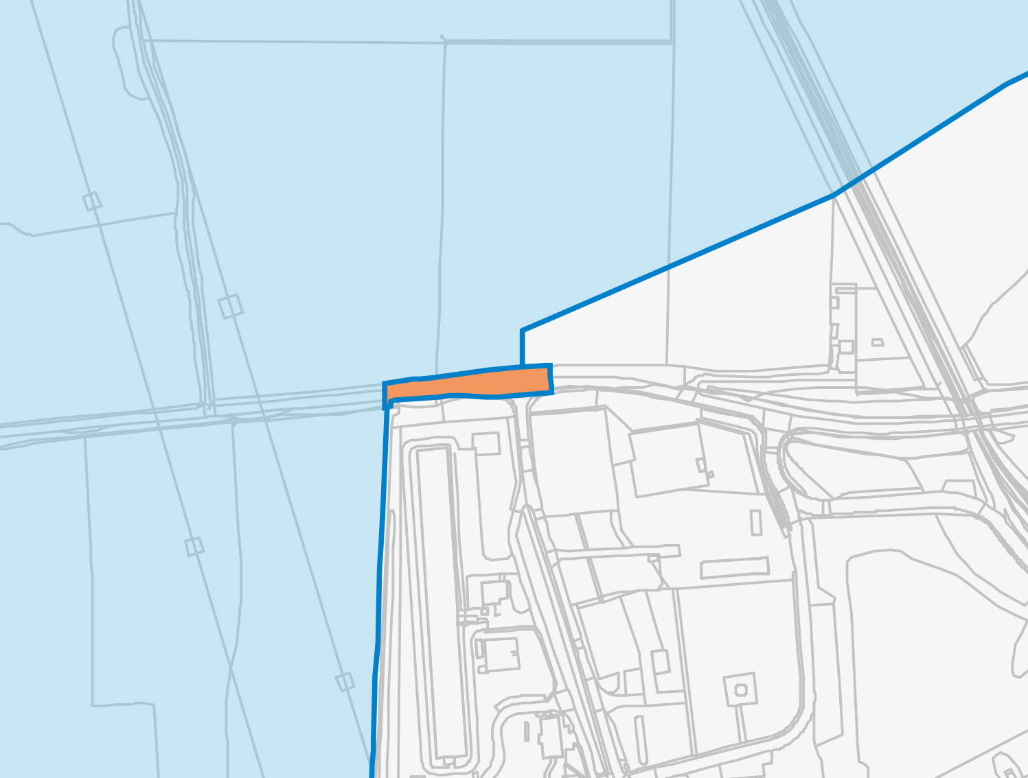
- Land south/east of Broad Lane and Headstead Bank
- Headstead Bank/Town Street, Cottam
- Cottam Road (eastern extension)
- Cottam Road (western extension)
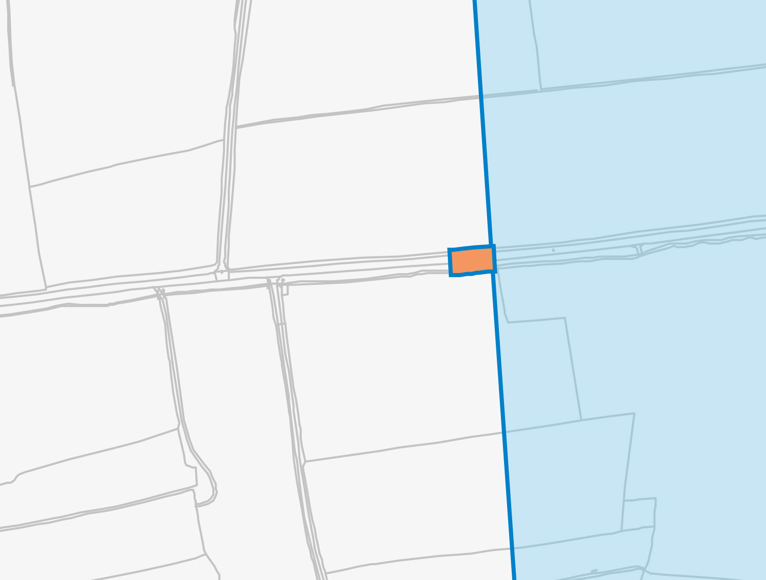
- Green Lane/Rampton Road Junction
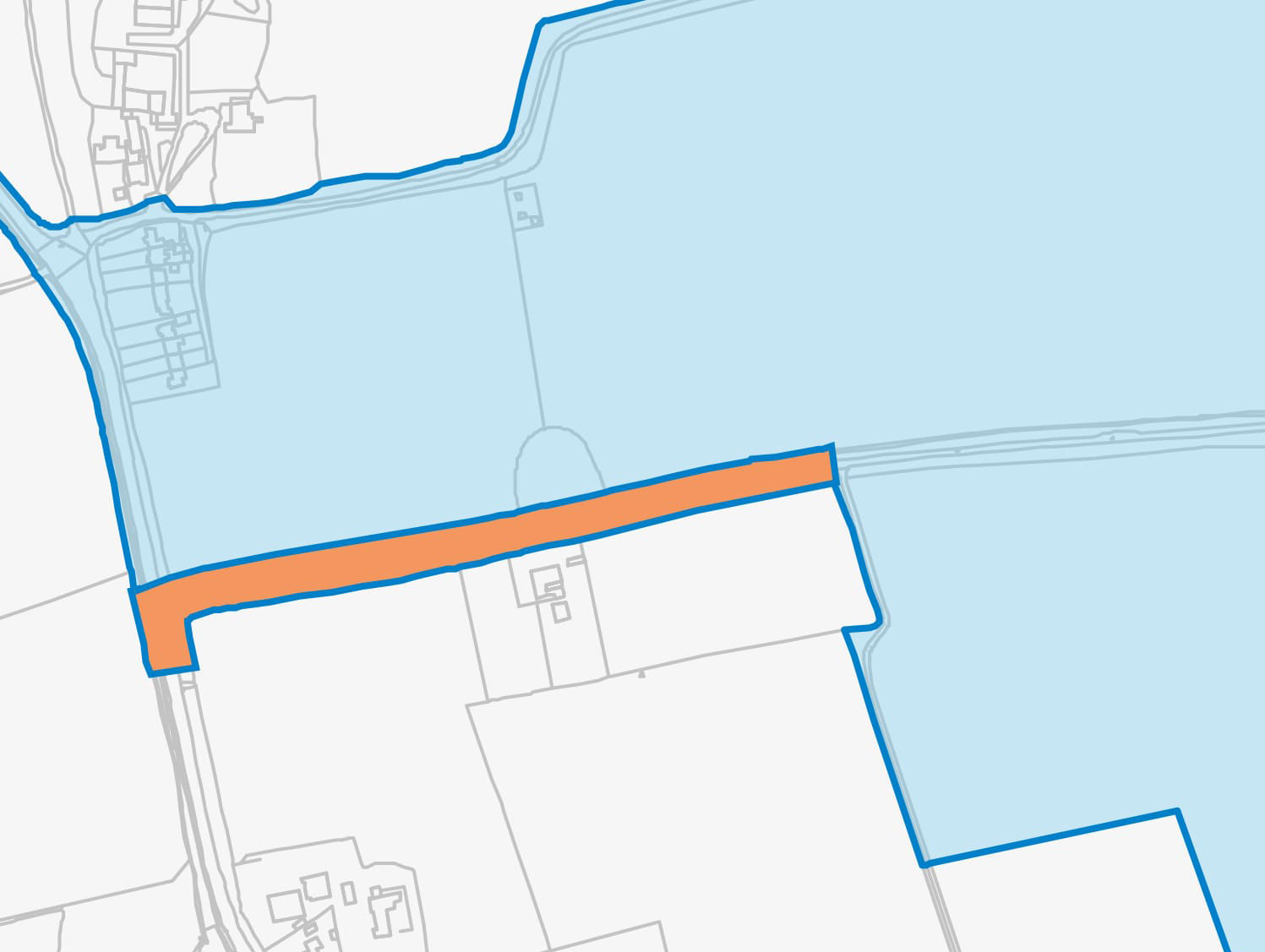
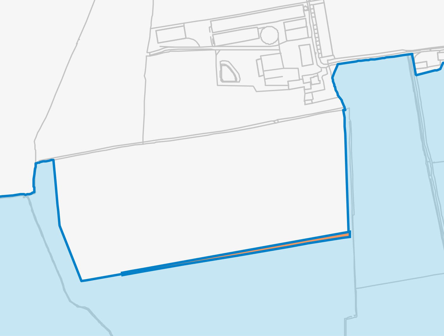
- North of Cottam Substation
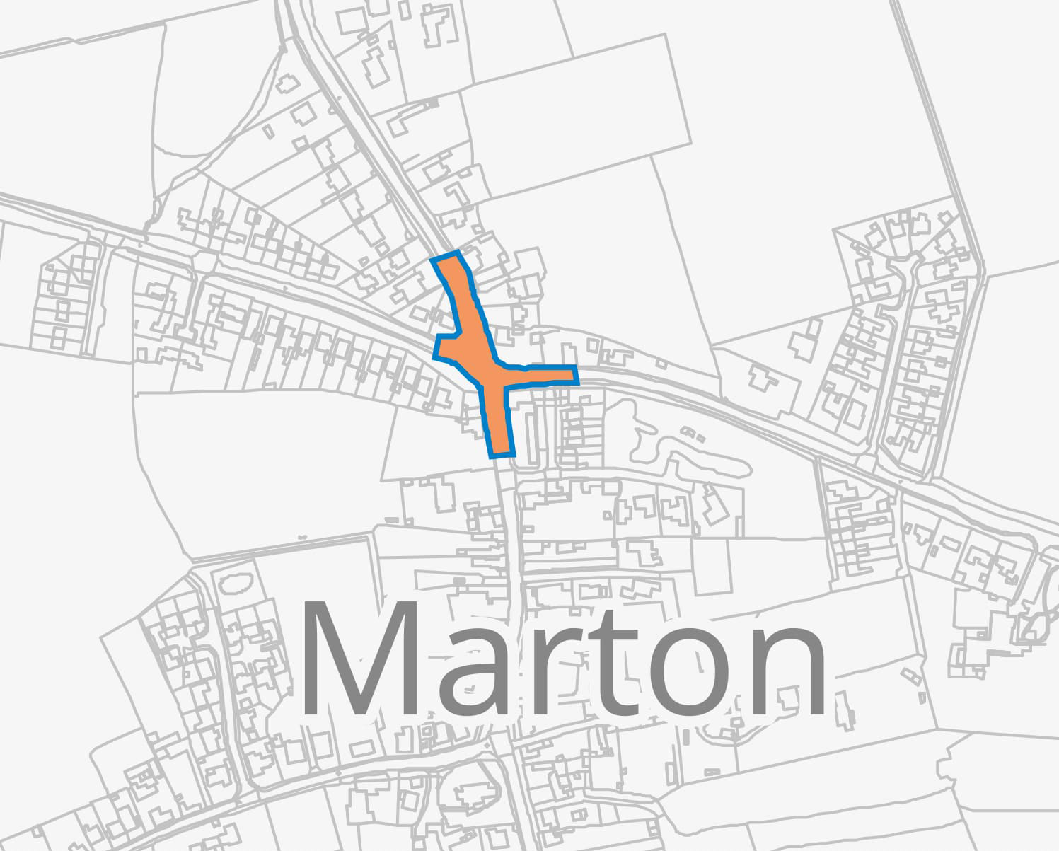
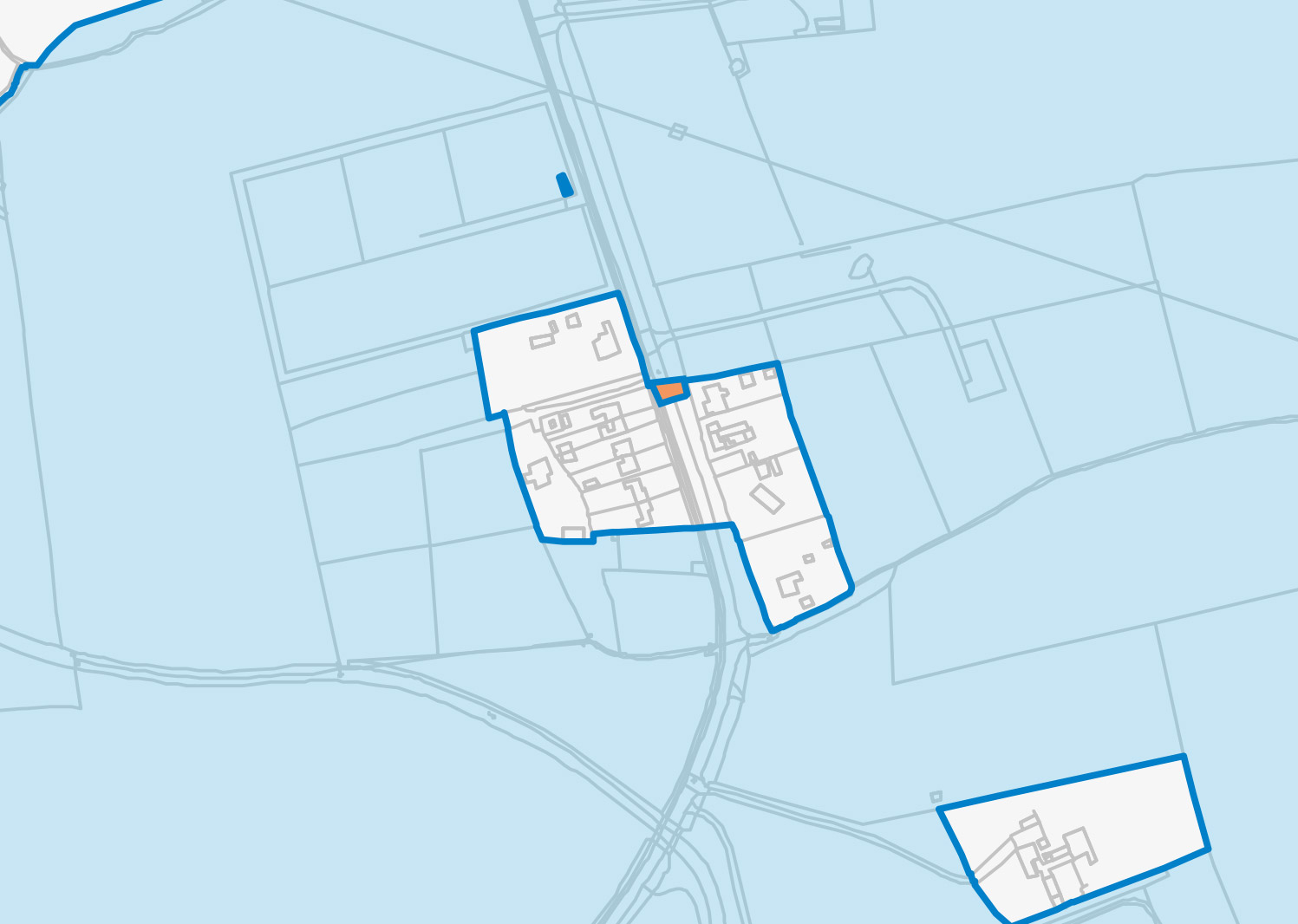
- Marton Road
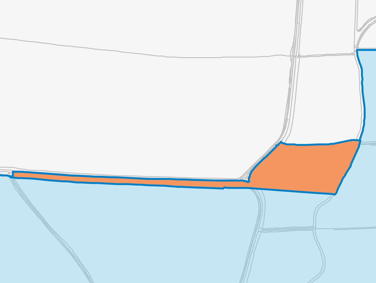
- Land south of Park Farm
| 1. Kexby Lane East | |
|---|---|
| Why the change was proposed | Transport and access requirements. |
| Description of change | The Order Limits have been changed to accommodate the potential for areas of vegetation removal along the highway. This will ensure there is sufficient visibility for vehicles to safely access the construction compounds. |
| 2. Kexby Lane West | |
|---|---|
| Why the change was proposed | Transport and access requirements. |
| Description of change | The Order Limits have been changed to accommodate the potential for areas of vegetation removal along the highway. This will ensure there is sufficient visibility for vehicles to access the construction compounds safely. |
| 3. Within site – adjacent to main construction access | |
|---|---|
| Why the change was proposed | Due diligence |
| Description of change | The Order Limits have been adjusted to align with the ownership and field boundary. |
| 4. A156 – west of Gate Burton | |
|---|---|
| Why the change was proposed | Engineering and feasibility. |
| Description of change | The Order Limits have been changed to allow for connection to an existing water main along the A156 – enabling provision of a water supply directly to the sub-station and battery storage facility.
The exact point of connection is still to be determined and will be confirmed in the detailed design. |
| 5. A156 – Willingham Road | |
|---|---|
| Why the change was proposed | Engineering and feasibility |
| Description of change | The Order Limits have been changed to allow for a proposed connection to an existing water main along the A156/Willingham Road, so water can be provided to the sub-station and battery storage facility.
The exact point of connection is still to be determined and will be confirmed at detailed design. |
| 6. A156 – 1500 (Stow Park Road) – Littleborough Road junction | |
|---|---|
| Why the change was proposed | Transport and access requirements |
| Description of change | The Order Limits have been changed to accommodate highway improvements at this junction.
This is to accommodate abnormal indivisible loads travelling to the Solar and Energy Storage Park (north) and the Grid Connection Corridor (south). |
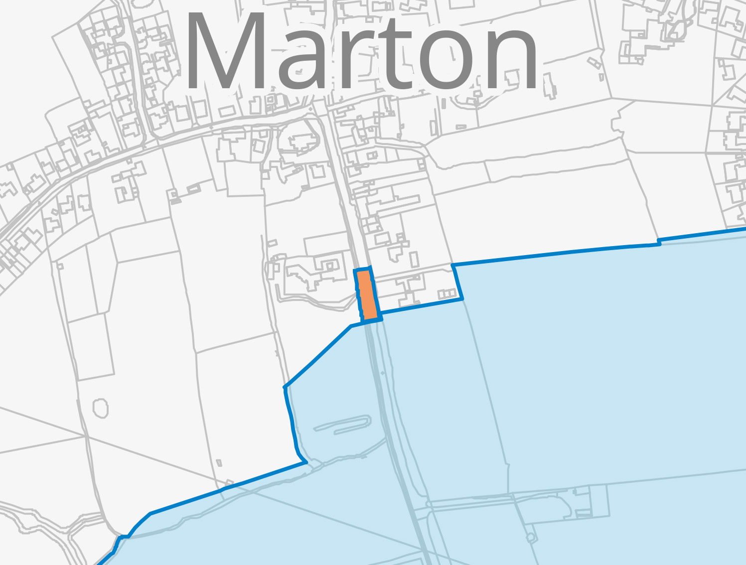
| 7. A156 South of Marton (northern extension) | |
|---|---|
| Why the change was proposed | Transport and access requirements |
| Description of change | The Order Limits have been changed to accommodate the potential for areas of vegetation removal along the highway. This will ensure there is sufficient visibility for vehicles to access the proposed Grid Connection Corridor safely. |
| 8. A156 South of Marton (southern extension) | |
|---|---|
| Why the change was proposed | Transport and access requirements |
| Description of change | The Order Limits have been changed to accommodate the potential for areas of vegetation removal along the highway. This will ensure there is sufficient visibility for vehicles to access the proposed Grid Connection Corridor safely. |
| 9. Land south/east of Broad Lane and Headstead Bank | |
|---|---|
| Why the change was proposed | Engineering and feasibility |
| Description of change | The Order Limits have been widened to follow the field boundaries, which will allow flexibility for installation of the 400kV cable connections from Gate Burton Energy Park to the substation. |
| 10. Headstead Bank/Town Street, Cottam | |
|---|---|
| Why the change was proposed | Transport and access requirements |
| Description of change | The Order Limits have been changed to allow for abnormal indivisible loads accessing the Grid Connection Corridor. Improvements may need to be made along this stretch of road to enable access for larger vehicles. |
| 11. Cottam Road (eastern extension) | |
|---|---|
| Why the change was proposed | Transport and access requirements. |
| Description of change | The Order Limits have been changed to accommodate the potential for areas of vegetation removal along the highway. This will ensure there is sufficient visibility for vehicles to access the proposed Grid Connection Corridor safely. |
| 12. Cottam Road (western extension) | |
|---|---|
| Why the change was proposed | Transport and access requirements. |
| Description of change | The Order Limits have been changed to accommodate the potential for areas of vegetation removal along the highway. This will ensure there is sufficient visibility for vehicles to access the proposed Cable Connection Corridor safely. |
| 13. Green Lane/Rampton Road Junction | |
|---|---|
| Why the change was proposed | Transport and access requirements |
| Description of change | The Order Limits have been changed to allow for abnormal indivisible loads accessing the Grid Connection Corridor.
Improvements may need to be made to the junction to enable access for larger vehicles turning. |
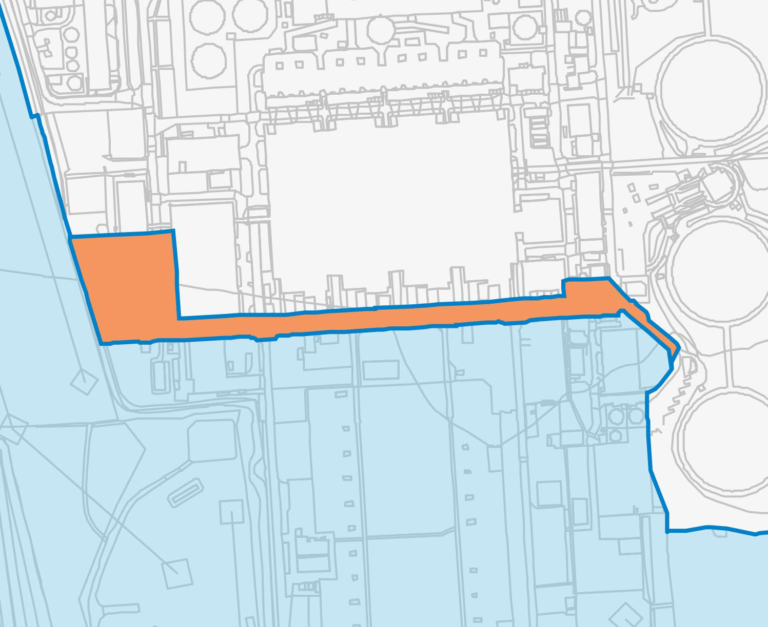
| 14. North of Cottam Substation | |
|---|---|
| Why the change was proposed | Engineering and feasibility |
| Description of change | The Order Limits have been changed to enable the grid connection into Cottam Substation. |
| 15. Marton Road | |
|---|---|
| Why the change was proposed | Transport and access requirements. |
| Description of change | The Order Limits have been changed to accommodate the potential for areas of vegetation removal along the highway. This will ensure there is sufficient visibility for vehicles to safely access the site. |
| 16. Land south of Park Farm | |
|---|---|
| Why the change was proposed | Due diligence |
| Description of change | The Order Limits have been adjusted to align with the ownership and field boundary. |
Environmental Impact Assessment
The additional areas and associated activities including their nature, extent and duration have been reviewed as part of the environmental assessment. The additional areas do not change the significant effects of the environmental impact assessment that was set out in the Preliminary Environmental Information (PEI) Report, the findings from which we sought views on for our Stage Two Statutory Consultation.
What happens next
Now the consultation has closed we are reviewing our proposals in light of all the comments we received, along with the findings from our ongoing assessments, so we can finalise our proposals for the project.
As the developer we have a duty to demonstrate how we have taken your views into account in developing our final proposals. Our final application for development consent will therefore include a Consultation Report summarising the responses submitted to this consultation along with an explanation of how we’ve had regard to the views expressed in developing our final proposals.
A copy of the Consultation Report, along with our other application documents, will be published on the Planning Inspectorate's website if and when our application has been accepted. We will write to or email everyone who has taken part in the consultation to let them know when this information is available to view.
Register for updates
If you would like to receive updates about the Project and the ongoing development process, please register your details with us.